Secret Pittsburgh
A South Side Step to the Past
By Jacob Kachurka
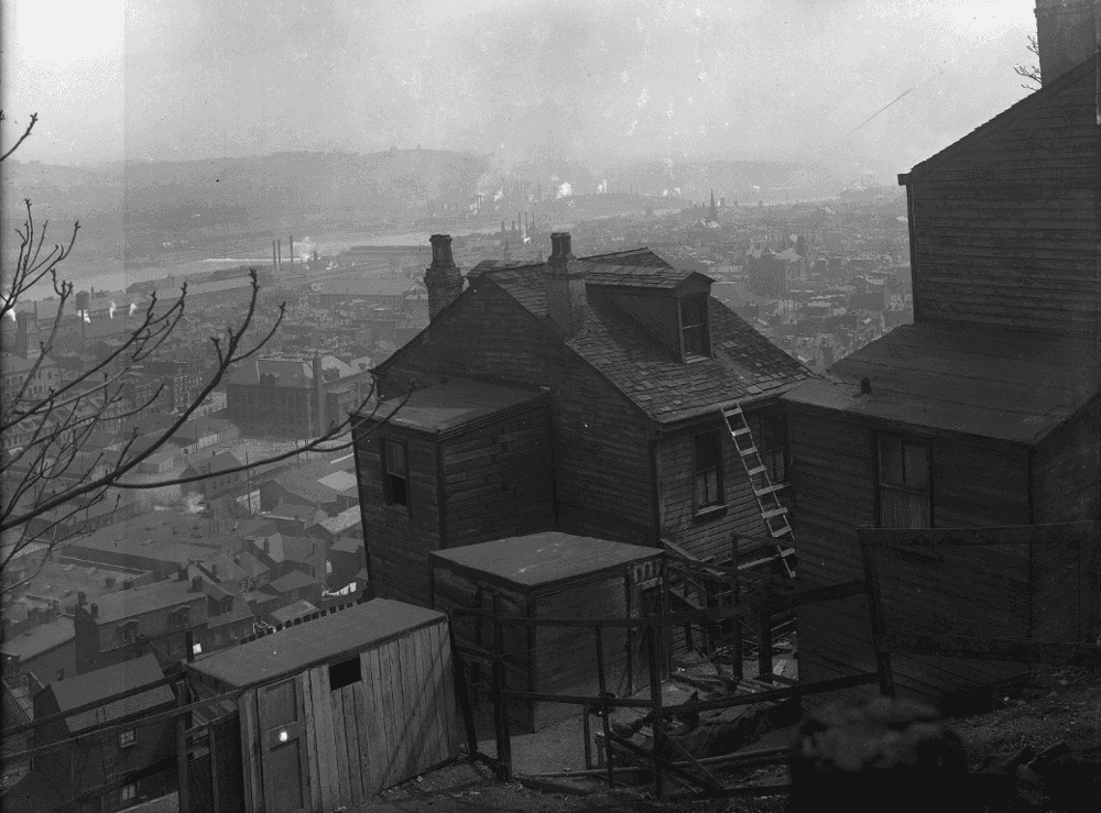
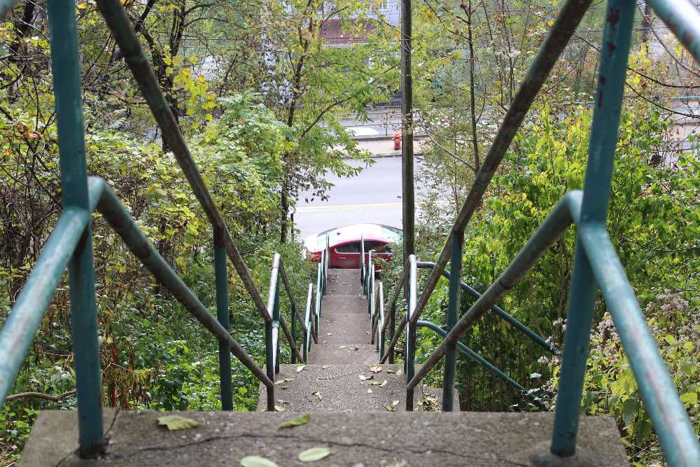
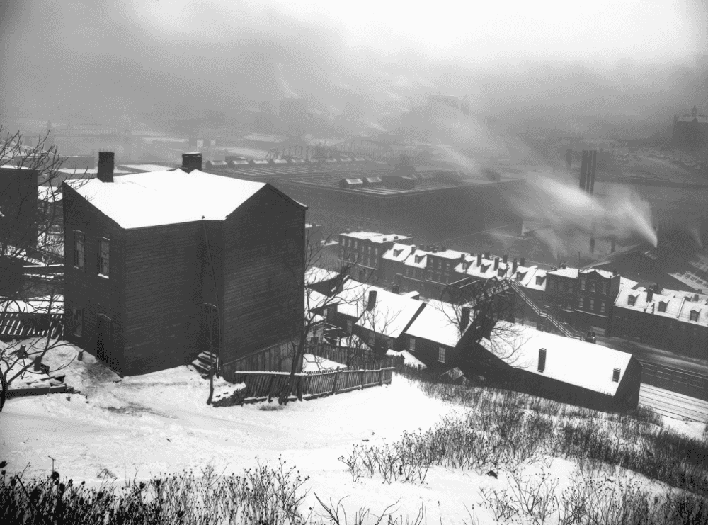
We arrived at the beginning of the Church Route on East Carson Street bundled up in layers. It was a chilly day with a breeze blowing across the Flats from the Monongahela valley, and being from Texas, I was shivering (to my embarrassment) even though it was a sunny afternoon and I wore my winter coat. However, after hiking the 19 stories up the South Side Slopes, I was stripped down to just my t-shirt and ready for a post-workout, cold, shower. That trek up the steps was difficult for me, and all I had done prior to the climb was lie in bed and take a bus to the South Side. One hundred years ago, a factory worker making that same trip would either be heading to or returning from a grueling shift in Pittsburgh’s steel and glass mills. Their climb would be in a haze of smog in a pre-workers’ safety world. Today, the clean-ish air, cars, and public transport make traveling up the Slopes a much easier feat to accomplish, hence the new influx of residents moving in to take advantage of the great views of the city. During the peak of industry in Pittsburgh though, people lived in the neighborhood for completely different reasons.
The Southside Flats, due to its long span of flat land on the Monongahela River, was prime real estate for factories to set up shop. Of course, these factories needed low-wage workers to keep them running, which is where European immigrants, mostly from non-Western European countries like Poland, Germany, Lithuania, and many Slavic countries, filled the demand. Due to how low their wages were, the immigrants weren’t able to afford to live in neighborhoods like Oakland or Squirrel Hill, and living far away in the South Hills wasn’t feasible with the lack of infrastructure at the time. Considering the cost of living and distance from the factories, the hillside next to the Flats was the most reasonable place for the worker communities to settle.
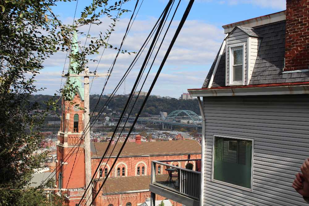
The most visible mark that these communities left on the neighborhood today is the high concentration of churches founded by the different ethnic groups in such a small area. As you walk through the Slopes on the Church Route, you will first pass by St. Adalbert’s (founded by Polish immigrants) and its school building at the base of the hillside. Halfway up the route, St. Michael’s (founded by German immigrants) and its accompanying building will flank you on both sides of Pius Street, and at the top, the 11 acre compound of St. Paul of the Cross Monastery (founded by Italian monks) can be found watching over the Pittsburgh skyline.
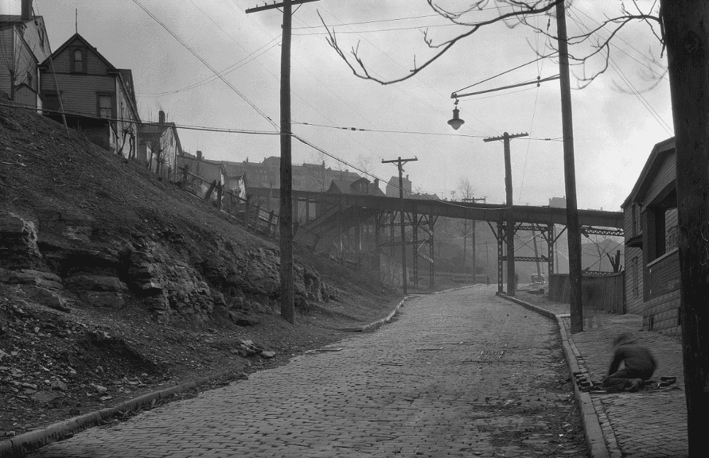
Pittsburgh is a unique city based on its geography alone. Its neighborhoods nestled in between the hills and valleys, utilizing whatever flat, developable land they can. However, the pressures making the Slopes a necessity to live in for the immigrant laborers broke that development pattern. Land that most would say is unable to be, or not even worth developing, was forced to become a densely packed, vertically oriented, neighborhood. Almost every man living in the Slopes would have needed to walk up and down part of the 440 foot tall, 40 story, neighborhood every day for work because, at the time, there were no buses to take or cars to drive to avoid the hike. Due to how difficult the commute was, seventy sets of staircases and three inclines were constructed from the Flats to the varying points up the hillside, which of course were wildly popular with tired workers going home after work, and would have been even more popular with me if the inclines were still present when I walked the Church Route. With the factories close by in the Flats, a church on every corner, and many options available to traverse the steep hillside, the Slopes fit the needs of the hard-working, religious, residents of the past perfectly.
However, the wants and needs of the Slopes residents one hundred years ago of course don’t fit with what the neighborhood desires in 2021. Today, the South Side Flats couldn’t be more different than the industrial Flats of the past. What used to be filled with blue-collar workers, steel mills, and pollution is now replaced by bars, students, young adults, bars, apartments, and more bars. During the day, as you walk through the Flats at the beginning and the end of the Church Route, you’ll see a wide variety of residents, with a mix of families and young adults in their apartments at least a block away from East Carson Street. But, make the same trip at night and all you’ll notice is a horde of intoxicated young adults packing East Carson Street, leaving the rest of the neighborhood more or less empty, almost as if the residents are hiding from the chaos just a block or two away. The gradual change away from industry in the Flats meant that the Slopes had to change as well. The driving force for the South Side Slopes’ original settlement was now gone with the departure of the factory jobs, and newly built infrastructure connecting the suburbs to the city made it more appealing to those previously living in the Slopes to move away. Although most people own cars now, the trip from the Slopes to the Flats is still difficult due to many homes not having road access and all three South Side inclines closing by the 1960s.
As I walked the Church Route, what I kept noticing other than the pain in my knees and sweat dripping down my face was the lack of any actual operating churches on the so-called “Church” Route. St. Adalbert’s and both of the St. Michael’s facilities were either in the process of being completely renovated as upscale condos or had already been renovated years ago. Like with the changed demographics of the Flats, that same change is happening with the Slopes. Young adults, who become less and less religious as the years pass, move to the neighborhood and replace the previously religious residents. Walking past the eerie husks of buildings that used to be places of worship and community, which now house young people looking for a fancy new condo with a view, almost felt heretical to me. The parishes that had occupied the now-condos have since consolidated with other churches in the area facing the same lack of attendance problem, and it’s only a matter of time until those new parishes will have to consolidate again.
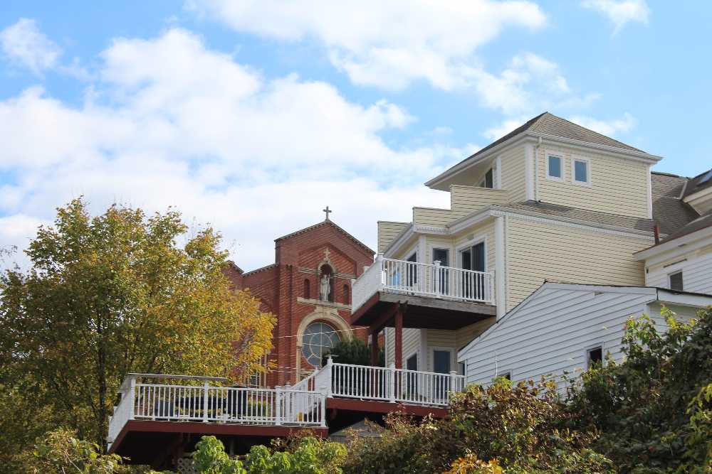
Like with condos bringing new life to the corpses of churches to fit what the new residents want, my walk up the steps also revealed a hodge-podge of old and new houses. A great view of the city has become the main selling point of homes in the Slopes. New residents buy old homes with the potential of a nice view and renovate them with a new deck overlooking the city as the focal point. For every home that I passed that hadn’t been renovated in what seemed like decades, there was a modern home with a huge, brand new deck projecting out over a sickening drop looking towards the skyline.
The Slopes' value to its residents has always been tied to the unique geography that it sits on. In the past, the biggest reason to live in the neighborhood was due to its adjacency to the Flats, and nothing to do with the actual neighborhood itself. In most cases, the hillside was seen as a deterrent due to how difficult it was to traverse. Today, the Slopes have their own intrinsic value, independent of the Flats. Although the closeness to the Flats definitely doesn’t hurt, if it were flooded tomorrow by the Monongahela, the value of having a great view of the city would still exist. With the neighborhood on the upswing with a lot of renovation and investment, there is still plenty to come for new residents making the South Side Slopes their home.
Works Cited
Bender, J. (2021, November 5). [Photograph of St. Michael's Church].
Bender, J. (2021, November 5). [Photograph of South Side Slopes home].
Bender, J. (2021, November 5). [Photograph of South Side Slopes stairway].
Lynch, K. (1964). The image of the city. MIT Press.
Pittsburgh (Pa.). City Photographer. (1909, January 13). View from the South Side Slopes
[Photograph]. Historic Pittsburgh. https://historicpittsburgh.org/islandora/object/pitt%3A715.092103.CP
Pittsburgh (Pa.). City Photographer. (1918, May). South Side Dwelling and the Surrounding Area
[Photograph]. Historic Pittsburgh. https://historicpittsburgh.org/islandora/object/pitt%3A715.1851.CP
Pittsburgh (Pa.). City Photographer. (1933, February 2). Monastery Street [Photograph]. Historic
Pittsburgh. https://historicpittsburgh.org/islandora/object/pitt%3A715.3317977.CP
